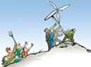
If Vermont Yankee shuts down in 2012, the state will have to start looking elsewhere to meet its energy needs. But “elsewhere” might be in our own backyards. Advocates for renewable energy sources such as biomass, wind and solar want to make local power happen right here. The soon-to-be launched Renewable Energy Atlas of Vermont could accelerate that process.
The online atlas is a project of the Vermont Sustainable Jobs Fund that allows users — both consumers and renewable energy providers — to get a picture of the sustainable-energy portfolio not only within the state but in their own neighborhoods. Consumers can see how many residential wind turbines spin in Richmond or how much a household in Barre could save from a solar panel installation.
The website, which goes live on Earth Day, was a year in the making, says Scott Sawyer, atlas project manager for the VSJF. The project cost $200,000, the bulk of which came from the U.S. Department of Energy through Sen. Patrick Leahy’s office, with contributions from Green Mountain Coffee Roasters, the Vermont Community Foundation and the Vermont Clean Energy Development Fund.
The GIS-based web application is the first of its kind to identify, analyze and visualize existing and potential locations for renewable energy projects around the state, says Sawyer. The reason for the website, he reasons, is simple: “We are trying to relocalize production to help us deal with peak oil and climate change,” Sawyer says. “We also want to help stem the flow of money that leaves Vermont.”
The website works like this: Users choose a geographical area on the map and then pick an energy option — biomass, efficiency, geothermal, hydro, solar or wind. Within each of those categories, it’s possible to drill down to more specific energy options such as methane digesters or hydroelectric dams. From there, a click on the website produces a map. Results range from a small biofuel producer in Essex Junction to Green Mountain Power’s Searsburg wind farm.
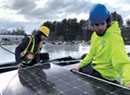
If you were looking for solar arrays in Huntington, for example, the atlas would show seven net-metered sites, which feed excess energy back into the grid, and two non-net-metered sites. On the website’s interactive map, you’d see that the Brewster Pierce Memorial School boasts photovoltaic panels, as does the Foundation for a Sustainable Future, the Enman family, and Brenda Waters on Blueberry Lane.
If you’re exploring residential wind options in Addison County, the atlas reveals four 30-meter turbines in Lincoln, three in New Haven and one each in Leicester, Orwell and Ripton, as well as 15 others countywide. As for woody biomass such as pellet boilers, only Mt. Abraham High School and Middlebury College currently heat that way in Addison County.
The atlas lets consumers research renewable options in their town before making any sort of commitment, says Scott Merriam, a project coordinator for Renewable Energy Vermont. “It’s definitely feeding that ‘just curious’ gap,” he says. “It plants an idea for people.”
It’s an opportunity for businesses, too. Alternative-power brokers may use the website to “target certain areas” for potential projects, says Merriam. Those companies that provide energy services, such as many of the 300 members of REV, will be listed in the resources section, along with financing information.
Johanna Miller, energy program co director for the Vermont Natural Resources Council, says the atlas will help towns evaluate their renewable energy potential. Currently, nearly 100 communities around the state have town energy committees — volunteer groups that work to recreate more affordable, sustainable energy portfolios for their communities.
“It will offer a first glimpse of what might be possible,” Miller says.
The website was built with help from the Vermont Center for Geographic Information and Fountains Spatial, a GIS service provider in Montpelier. While developing the atlas, Sawyer and others combed through databases such as the Biomass Energy Resource Center and the Vermont Dam Inventory to get up-to-date information on each renewable option. The website aggregates all of the resulting data.
Sawyer cautions that, as with any journey, the atlas should be a first step in planning any sort of renewable energy project — not the last.


Comments
Comments are closed.
From 2014-2020, Seven Days allowed readers to comment on all stories posted on our website. While we've appreciated the suggestions and insights, right now Seven Days is prioritizing our core mission — producing high-quality, responsible local journalism — over moderating online debates between readers.
To criticize, correct or praise our reporting, please send us a letter to the editor or send us a tip. We’ll check it out and report the results.
Online comments may return when we have better tech tools for managing them. Thanks for reading.